
|
|
|
|
|||||||
| General Discussion (Everything Else) Discuss anything that doesn't belong in any other forums here. |
 |
|
|
Thread Tools | Display Modes |
|
#1
 05-09-2015, 11:03 PM
|
||||
|
||||
|
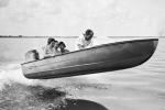
First two are the Chen, next two are Boston, last two are 4 mile cut. This will be it for a while, boat is going into the shop so I will be bumming rides. 
|
|
#7
05-10-2015, 08:15 PM
|
||||
|
||||
|
Quote:
I can do the contour map if yall are willing to record sonar logs and send em to me. All that is needed is a GPS unit that can record sonar and a free Google Drive account. PM Me if you are interested.
|
|
#8
05-10-2015, 08:51 PM
|
||||
|
||||
|
Quote:
Mud point, cove, and the point.
|
|
#9
05-17-2015, 08:00 PM
|
|||
|
|||
|
Quote:
|
|
#10
05-17-2015, 09:01 PM
|
||||
|
||||
|
Quote:
|
|
#11
05-17-2015, 11:15 PM
|
||||
|
||||
|
In Reefmaster you can choose the width you want. For the small areas the map i usually run the maps on 50 meter. Meaning I need to be within 50 meters of a track to fill in data. For the open bay I run them on 100 meter.
If I see an area of intrest I will make multiple passes over the area to get as much detail as I can.
|
|
#12
05-18-2015, 05:25 AM
|
|||
|
|||
|
Quote:
|
|
#13
05-18-2015, 11:05 AM
|
||||
|
||||
|
You have to be familiar with the area before you go. also you do need to make more passes in shallow areas. Also speed plays a difference in the recordings. in the pics below you can see red line is sonar returns. to the left i was going about 20 mph then slowed down to Idle speed. the red dots indicate sonar returns. Notice how they are spread out then, once I slow down you get more returns per foot.
Second Pic shows 31mph, i am getting a return every 11 ft max +/- if I see a blip, i will go back and map the area in detail at idle speed to get the most information.
|
|
| Bookmarks |
|
|


 Linear Mode

