
|
|
|
|
|||||||
| Inshore Saltwater Fishing Discussion Discuss inshore fishing, tackle, and tactics here! |

 |
|
|
Thread Tools | Display Modes |
|
#21
 11-10-2009, 01:32 PM
|
||||
|
||||
|
Zone Forecast: [SIZE=2]Coastal waters from Intracoastal City to Cameron LA out 20 NM (GMZ452)[/SIZE]Mobile Weather Information Last Update: 938 AM CST TUE NOV 10 2009 [IMG]http://forecast.weather.gov/images/***/marinezonebanner.jpg[/IMG] Hazardous marine condition(s): Synopsis...MODERATE TO STRONG NORTHERLY WINDS WILL CONTINUE OVER THE COASTAL WATERS AS HIGH PRESSURE BUILDS SOUTH IN THE WAKE OF TROPICAL STORM IDA TO THE EAST. WINDS WILL FINALLY BEGIN TO SUBSIDE LATE WEDNESDAY INTO EARLY THURSDAY AS HIGH PRESSURE APPROACHES THE REGION. Today...North winds 15 to 20 knots. Seas 4 to 6 feet subsiding to 3 to 5 feet in the afternoon. Tonight...North winds 15 to 20 knots. Seas 3 to 5 feet. Wednesday...North winds 15 to 20 knots. Seas 3 to 5 feet. Wednesday Night...North winds 15 to 20 knots. Seas 3 to 5 feet. Thursday...Northeast winds 10 to 15 knots. Seas 1 to 3 feet. Friday...South winds 5 to 10 knots. Seas 2 to 4 feet. Saturday...Southeast winds 10 to 15 knots. Seas 2 to 4 feet. A slight chance of showers. [IMG]http://forecast.weather.gov/images/***/currentconds_down.jpg[/IMG] CAPL1 8768094 - Calcasieu Pass Lat: 29.77°N Lon: 93.34°W Elev: 0 Last Update on Nov 10, 11:42 am CST N 17 G 21 KT 1018.0 mbAir Temperature:72 °F (22 °C)Water Temperature:68 °F (20 °C)Dewpoint:NAWave Hgt/Dir:NADominant Wave Period:NAVisibility:NANearby Observations:Past Observations:[IMG]http://forecast.weather.gov/images/***/radandsat.jpg[/IMG]  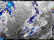

|
|
| Bookmarks |
|
|


 Linear Mode

