
|
|
|
|
|||||||
| Inshore Saltwater Fishing Discussion Discuss inshore fishing, tackle, and tactics here! |
 |
|
|
Thread Tools | Display Modes |
|
#21
 07-09-2013, 05:49 PM
|
||||
|
||||

|
|
#23
07-09-2013, 08:18 PM
|
||||
|
||||
|
Quote:
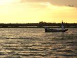
shallow as others have said. ImageUploadedByTapatalk1373418975.939110.jpg
|
|
#24
07-09-2013, 08:25 PM
|
||||
|
||||
|
My first year living south of I-10 me and bro in-law went thru Onion Lake when the tide was high and fished around south of there a while. Fished til dark and headed back in. Tide was ripping out, and we went about 1/2 mile into Onion Lake kicking up mud and got stuck. 1 hour of pushing and got back into deeper water and kept running onto mudflats so finally tried to go back west and ran out of gas
|
|
#25
07-09-2013, 08:27 PM
|
||||
|
||||
|
Quote:
|
|
#26
07-09-2013, 09:27 PM
|
||||
|
||||
|
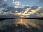
ImageUploadedByTapatalk1373422964.479310.jpgImageUploadedByTapatalk1373423013.568431.jpgImageUploadedByTapatalk1373423033.777034.jpg
These are some places you can enter the Lil bay off of the four mile safely. I've been seeing crabbers use these paths, so if they can pass, I think almost any bay boat can pass.
|
|
#27
07-09-2013, 09:30 PM
|
|||
|
|||
|
stay all the way close to the left bank when running onion lake, stay on step, canal turns to the left when you get to the end of the lake, also goes straight, but very shallow there. It ends in a dead end, I have caught bass and reds the same day back there. but thats been a few years, only thing back there now is flounder.
|
|
#28
07-09-2013, 09:31 PM
|
||||
|
||||
|
I would say 3-4' never checked it with a depth finder, but passed it many times in a bay boat. I would be careful pretty much any where in lil bay and fearman with a hard north wind in the winter though.
|
|
#30
07-09-2013, 09:44 PM
|
||||
|
||||
|
Good luck, on another hand Friday is looking up they dropped that Wind big time looking to be the calmest day of the week now.
|
|
#31
07-09-2013, 11:58 PM
|
||||
|
||||
|
Thanks for the info guys. I'll use it next time I go out there. It looks like I am not going to make it this Friday. Hopefully soon.
|
|
#32
07-10-2013, 12:51 AM
|
||||
|
||||
|
This is the route I always use. Hope it helps.
|
|
#33
07-10-2013, 04:51 AM
|
||||
|
||||
|
I like the info sent concerning 4 mile cut,etc. I would appreciate some pointers as to how you guys are able to draw lines and input messages upon the maps shown. I'm no big computer expert but would like to be able to do some of the stuff you guys have done. Thanks in advance for any help
|
|
#34
07-10-2013, 06:30 AM
|
||||
|
||||
|
I use a simple, free app called my maps.
|
|
#35
07-11-2013, 10:05 AM
|
||||
|
||||
|
Looks like my trip is back on. The only thing is ill have to leave work at 5 pm. Puts me at the launch at 6 ish. Better than going home to an empty house to do nothing.
|
|
| Bookmarks |
|
|


 Linear Mode

