SaltyCajun.com http://www.gator-tail.com/

Notices

Go Back   SaltyCajun.com > Fishing Talk > Offshore Fishing Discussion

Offshore Fishing Discussion Discuss everything bluewater from pelagics to reef fish here!

Reply
 
Thread Tools Display Modes
  #1  
Old 05-05-2014, 05:14 PM
alphaman's Avatar
alphaman alphaman is offline
Sailfish
 
Join Date: Sep 2010
Location: LAFAYETTE
Posts: 4,079
Cash: 3,710
Default Reefs east of marsh island

Has anyone fish these reefs? Rabbit island and there is another one I forgot the name of it that are pretty big. But there is also a bunch of small reef all in the area.

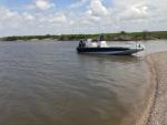
Are these small reefs still there. My gps shows a bunch of reefs
uploadfromtaptalk1399328051099.jpg

Sent from my SAMSUNG-SGH-I317 using Tapatalk
Reply With Quote
  #2  
Old 05-05-2014, 07:09 PM
daxt79's Avatar
daxt79 daxt79 is offline
Redfish
 
Join Date: Aug 2013
Location: Lafayette
Posts: 113
Cash: 708
Default

I haven't fished them so I can't help you there, but what card do you have that shows those reef's like that? Or is it a setting on you Lowrance?
Reply With Quote
  #3  
Old 05-05-2014, 07:51 PM
ronniem's Avatar
ronniem ronniem is offline
Redfish
 
Join Date: Feb 2014
Location: Rayne
Posts: 141
Cash: 909
Default

i never fished them but I have heard of people catching reds and specs at times around rabbit island...I think its more like a reef than an island though.Be careful if you go that way, I know there are some shallow water in areas out there and tons of trash on the bottom.
Reply With Quote
  #4  
Old 05-05-2014, 09:37 PM
alphaman's Avatar
alphaman alphaman is offline
Sailfish
 
Join Date: Sep 2010
Location: LAFAYETTE
Posts: 4,079
Cash: 3,710
Default

Thats the factory settings on my hds 7 touch. It show just about everything. Thats the reason I never bought a map card

Sent from my SAMSUNG-SGH-I317 using Tapatalk
Reply With Quote
  #5  
Old 05-06-2014, 09:38 AM
Reefman's Avatar
Reefman Reefman is offline
Tripletail
 
Join Date: Aug 2011
Location: lafayette
Posts: 957
Cash: 3,226
Default

Rabbit Island still exists but not as large as most of these maps will show. Most of the time under water and yes it can produce very good in late summer and fall. The reefs you're seeing on your gps are mostly gone or been flatten out by recent hurricanes. BUT there are remnants still there waiting to bust up a lower unit! BE careful running this area. Fishermen run through this area going to Eugene Isl rigs for specks. You will se anywhere from 7 ft to 3ft of water over those reefs. The next set of reefs going south would be the Nickel; this reef will expose at low tide. Give wide berth to this reef if running further. There is another reef SE of the Nickel that we call Lil Nickel. This reef tends to be deeper and much smaller but again some of this will expose during a low tide. The Nickel reef has no fish at any time of the year! Just keep on goin south to hit the rigs......
Reply With Quote
  #6  
Old 05-06-2014, 09:39 AM
rardoin rardoin is offline
Trophy Trout
 
Join Date: Sep 2013
Location: Lafayette
Posts: 310
Cash: 978
Default

Yes, the oyster reefs still exist. The center reef on your display is about where Nickel reef is located. There are reefs extending from the SE tip of MI which are the remnants of Shell Keys. Many of the reefs are just submerged at high tide and several are awash by 2ft or more at low tide. I am new to inshore fishing in the area and have only made a run out there once late last summer. Used live shrimp, live pogey, and fished on credit and only caught gafftops. I did fish them near low tide. I think it would have been better fishing on the rise/high tide. Those reefs should be heating up soon.
Reply With Quote
  #7  
Old 05-06-2014, 05:15 PM
alphaman's Avatar
alphaman alphaman is offline
Sailfish
 
Join Date: Sep 2010
Location: LAFAYETTE
Posts: 4,079
Cash: 3,710
Default

Thanks for the info fellas

Nickel reef, little nickel, shell keys, eugene or all labeled on my gps and the ones going west. I was just curios about all thise little reefs that I see on my gps

I wont be going around that area unless I am following someone that knows the area.

Sent from my GT-N5110 using Tapatalk
Reply With Quote
  #8  
Old 05-06-2014, 09:12 PM
Ratdog's Avatar
Ratdog Ratdog is offline
Red Snapper
 
Join Date: Dec 2011
Location: We're my boat is
Posts: 1,107
Cash: -514
Default

Quote:
Originally Posted by alphaman View Post
Thanks for the info fellas

Nickel reef, little nickel, shell keys, eugene or all labeled on my gps and the ones going west. I was just curios about all thise little reefs that I see on my gps

I wont be going around that area unless I am following someone that knows the area.

Sent from my GT-N5110 using Tapatalk
Just a note the state line does funny around there. Be shore u are not in Mississippi . Might not be close but like Japan and china it could be under dispute.

LOL

Good luck wish I lived near there. I would go with you. And hep in spotting and marking high spots. Less time with two boats swapping waypoints.

Man overboard.
Reply With Quote
  #9  
Old 05-06-2014, 09:44 PM
speck-chaser's Avatar
speck-chaser speck-chaser is offline
Ling
 
Join Date: Jul 2009
Location: new iberia
Posts: 3,764
Cash: 4,258
Default

[QUOTE=Reefman;687417]Rabbit Island still exists but not as large as most of these maps will show. Most of the time under water and yes it can produce very good in late summer and fall. The reefs you're seeing on your gps are mostly gone or been flatten out by recent hurricanes. BUT there are remnants still there waiting to bust up a lower unit! BE careful running this area. Fishermen run through this area going to Eugene Isl rigs for specks. You will se anywhere from 7 ft to 3ft of water over those reefs. The next set of reefs going south would be the Nickel; this reef will expose at low tide. Give wide berth to this reef if running further. There is another reef SE of the Nickel that we call Lil Nickel. This reef tends to be deeper and much smaller but again some of this will expose during a low tide. The Nickel reef has no fish at any time of the year! Just keep on goin south to hit the rigs......[/QUOTE]


Reply With Quote
  #10  
Old 05-07-2014, 10:17 AM
Reefman's Avatar
Reefman Reefman is offline
Tripletail
 
Join Date: Aug 2011
Location: lafayette
Posts: 957
Cash: 3,226
Default

Quote:
Originally Posted by speck-chaser View Post
. The Nickel reef has no fish at any time of the year! Just keep on goin south to hit the rigs.....


Nuttin but hard heads and gaff toppers!
Reply With Quote
  #11  
Old 05-07-2014, 10:19 AM
meaux fishing's Avatar
meaux fishing meaux fishing is offline
Great White
 
Join Date: May 2009
Location: Meaux
Posts: 12,531
Cash: 22,543
Default

Quote:
Originally Posted by Reefman View Post
Nuttin but hard heads and gaff toppers!
dont forget the monster stingrays that hang out there
Reply With Quote
  #12  
Old 05-07-2014, 01:44 PM
ike84 ike84 is offline
Redfish
 
Join Date: Dec 2011
Location: lafayette
Posts: 144
Cash: 984
Default

The one closest to south pt is there but its deep ~12'. There is a slight hump of shell I have never fished it but if you think the fish might be deep they may be there. The only ones that i know of that u can run aground are shell keys, blanc, nickle and rabbit island. Ive heard at times they are good. Its also a long run no matter where u launch.
Reply With Quote
  #13  
Old 05-07-2014, 02:15 PM
Reefman's Avatar
Reefman Reefman is offline
Tripletail
 
Join Date: Aug 2011
Location: lafayette
Posts: 957
Cash: 3,226
Default

Quote:
Originally Posted by ike84 View Post
The one closest to south pt is there but its deep ~12'. There is a slight hump of shell I have never fished it but if you think the fish might be deep they may be there. The only ones that i know of that u can run aground are shell keys, blanc, nickle and rabbit island. Ive heard at times they are good. Its also a long run no matter where u launch.
Not that far from Burns Point landing..better than running out of the Quintana. I do remember when it was almost a continuous reef from Point au Fer to east end of Marsh Island. Shell dredging and storms took out most of those reefs.
Reply With Quote
  #14  
Old 05-07-2014, 04:02 PM
ike84 ike84 is offline
Redfish
 
Join Date: Dec 2011
Location: lafayette
Posts: 144
Cash: 984
Default

Quote:
Originally Posted by Reefman View Post
Not that far from Burns Point landing..better than running out of the Quintana. I do remember when it was almost a continuous reef from Point au Fer to east end of Marsh Island. Shell dredging and storms took out most of those reefs.
When did they stop shell dredging? The 80's? Apparently the military used to target practice on rabbit island. I have found what look like morter shells there.
Reply With Quote
  #15  
Old 05-07-2014, 04:06 PM
wishin i was fishin's Avatar
wishin i was fishin wishin i was fishin is offline
Red Snapper
 
Join Date: Sep 2011
Location: Broussard
Posts: 1,110
Cash: 1,939
Default

I remember reading that those reefs were exposed. They dug them up to use as road bed foundations if i remember correctly.

Im gonna have to find that again.
Reply With Quote
  #16  
Old 05-07-2014, 05:01 PM
Reefman's Avatar
Reefman Reefman is offline
Tripletail
 
Join Date: Aug 2011
Location: lafayette
Posts: 957
Cash: 3,226
Default

Quote:
Originally Posted by wishin i was fishin View Post
I remember reading that those reefs were exposed. They dug them up to use as road bed foundations if i remember correctly.

Im gonna have to find that again.

Never knew that the military used Rabbit Isl. as a bombing site! When we first started fishing out there in the 70's as you approached East end it looked like white train cars lined up out there with all the reefs exposed most of the time! Best way to head out was to follow 200 yards off Marsh Island then make a turn to the SE after East point to avoid Shell Keys. Back then we had no GPS, Loran was only for the big boys. Depth sounders were a rare item on board most boats. Charts and a corrected compass was it. Fishing back then was a real adventure to say the least. As we would head back in we stopped at each rig to get the numbers so we could correlate it to the charts...fog was our worst enemy! The fishing on the first small platforms once clear of the reefs was nothing short of fantastic. Most all those close in rigs have been pulled. You very seldom had to run out to 74 or 51 to catch.
Reply With Quote
  #17  
Old 05-08-2014, 04:10 PM
Ratdog's Avatar
Ratdog Ratdog is offline
Red Snapper
 
Join Date: Dec 2011
Location: We're my boat is
Posts: 1,107
Cash: -514
Default

Quote:
Originally Posted by Reefman View Post
Never knew that the military used Rabbit Isl. as a bombing site! When we first started fishing out there in the 70's as you approached East end it looked like white train cars lined up out there with all the reefs exposed most of the time! Best way to head out was to follow 200 yards off Marsh Island then make a turn to the SE after East point to avoid Shell Keys. Back then we had no GPS, Loran was only for the big boys. Depth sounders were a rare item on board most boats. Charts and a corrected compass was it. Fishing back then was a real adventure to say the least. As we would head back in we stopped at each rig to get the numbers so we could correlate it to the charts...fog was our worst enemy! The fishing on the first small platforms once clear of the reefs was nothing short of fantastic. Most all those close in rigs have been pulled. You very seldom had to run out to 74 or 51 to catch.
I can confirm that.
At twelve years old all we had was a compus and a watch.

Good ol days gone on a heading we can't ride.
Reply With Quote
  #18  
Old 05-08-2014, 06:23 PM
wishin i was fishin's Avatar
wishin i was fishin wishin i was fishin is offline
Red Snapper
 
Join Date: Sep 2011
Location: Broussard
Posts: 1,110
Cash: 1,939
Default

it takes alot of talent to navigate there without a GPS, when I started fishing i would put my GPS on sonar and try and navigate by landmarks. Went to the wrong canals many times.

Respect to the captains before GPS.
Reply With Quote
  #19  
Old 05-08-2014, 09:39 PM
cajun bill cajun bill is offline
Tripletail
 
Join Date: Jul 2009
Location: Lafayette
Posts: 850
Cash: 792
Default

Quote:
Originally Posted by Reefman View Post
Nuttin but hard heads and gaff toppers!
X2
Reply With Quote
Reply

Bookmarks


Posting Rules
You may not post new threads
You may not post replies
You may not post attachments
You may not edit your posts

BB code is On
Smilies are On
[IMG] code is On
HTML code is Off

Forum Jump


All times are GMT -5. The time now is 12:17 PM.


Powered by vBulletin®
Copyright ©2000 - [ARG:3 UNDEFINED], Jelsoft Enterprises Ltd.
vB.Sponsors
vBCredits v1.4 Copyright ©2007 - 2008, PixelFX Studios
SaltyCajun.com logo provided by Bryce Risher

All content, images, designs, and logos are Copyright © 2009-2012,
Salty Cajun, LLC
No unathorized use is permitted
Geo Visitors Map